Experience Builder Web Application
The finished Experience Builder web application exhibits 4 pages. The Home or landing page, the Recreational Trail Rerouting Page, the Woodlot Income Page and the Types of Harvesting Practices in the Larose Forestry Page.
Home Page: The Home page features a description of the app and the history of the Larose Forest. It showcases the two interactive 3D scenes of the Larose Forest. Two fly over videos of the current and rerouted trail systems in the Larose Forest that have been embedded. The aim of this page is to orient a visitor to the web application on its use.
The Recreational Trail Rerouting Page: This page features interactive web scenes of two woodlots of the Larose Forest, 25B and 22A. The user can toggle between current and rerouted layers to explore the results of the spatial analysis performed. A short explanation of the criteria considered when rerouting the trails has been included.
The Woodlot Merchandisable Income Page: This page aims to promote the financial value of privately woodlots in the Larose Forest. An interactive web scene featuring harvesting income for stands in the Larose Forest between 2022 to 2025. The factors used to determine the monetary estimates are discussed further.
Ultimately, the web application is designed to provide a user-friendly interface with CRIBES’s signature theme and font. The user should have an engaging and interactive experience whilst educated on the wonders of the Larose Forest.
LiDAR 3D Woodlot Scenes
The team created two 3D scenes of woodlots within the Larose Forest. Below are static maps of created 3D Scenes from the ArcGIS Pro desktop application. To explore the 3D woodlots more, click on the woodlot name below to view created web scenes to explore the rerouted trails and woodlots in ArcGIS online!
Woodlot 22A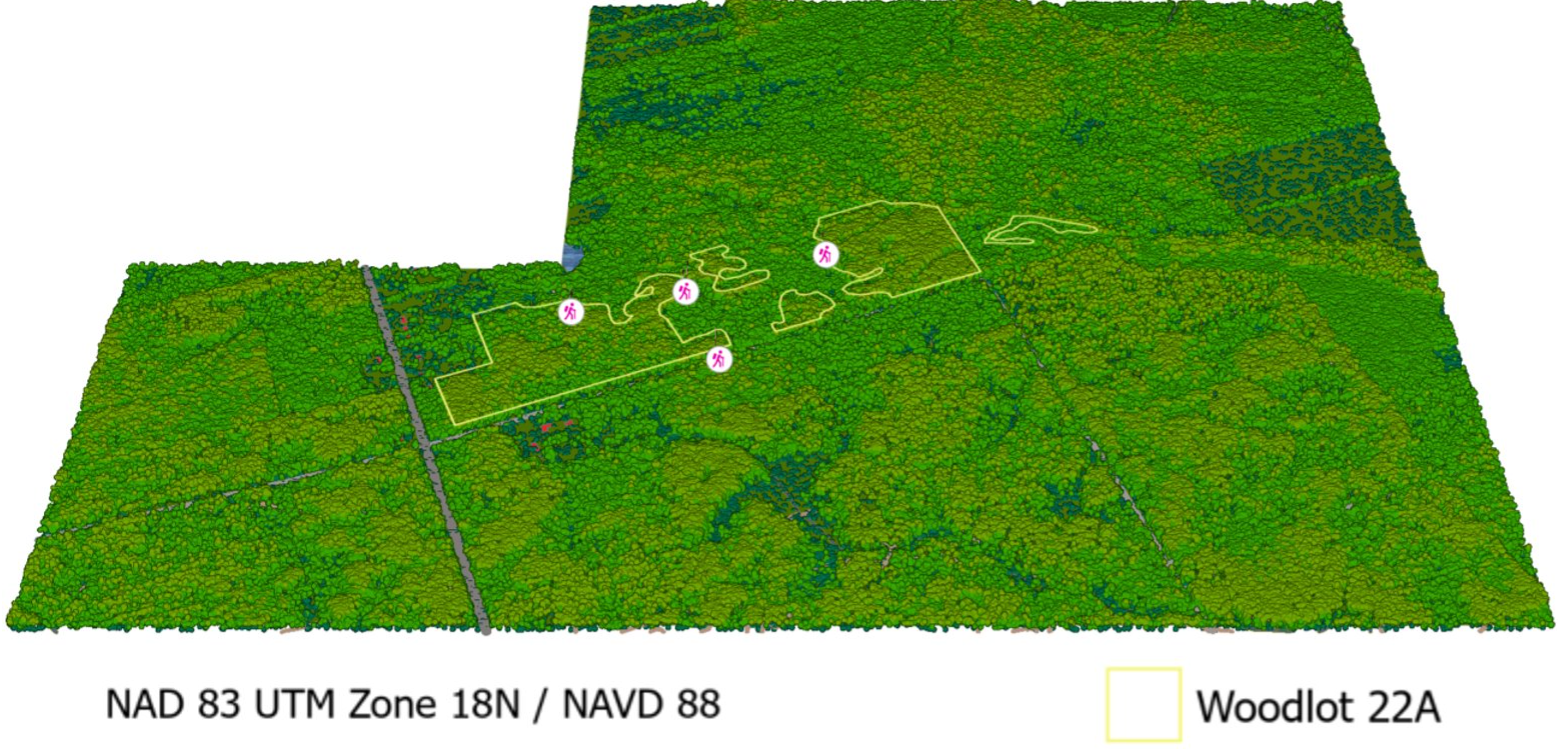 Woodlot 25B
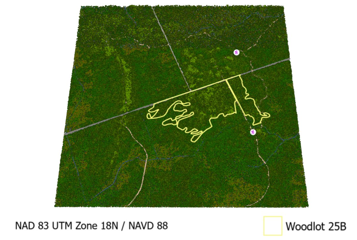
Fly-Over Video of Woodlot 25B
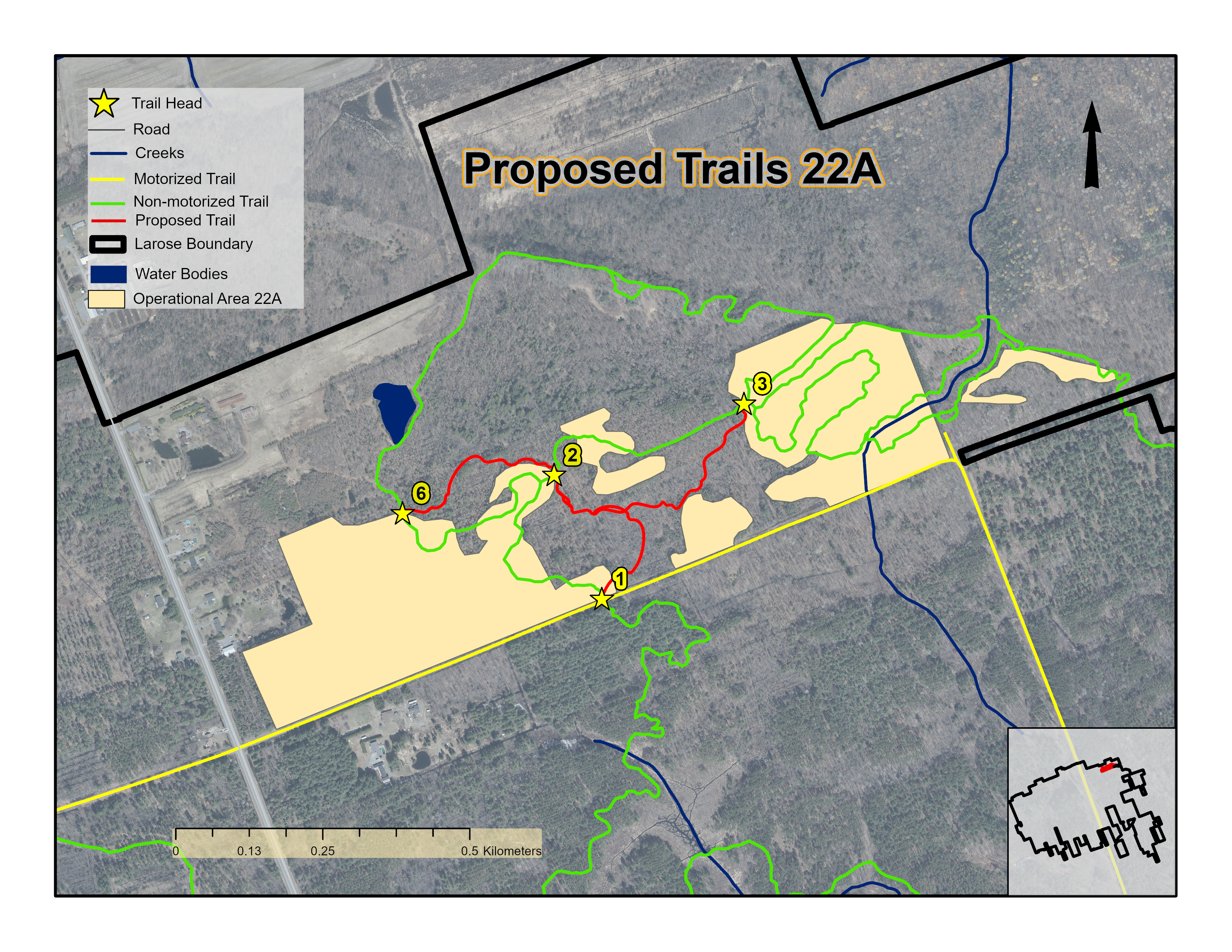
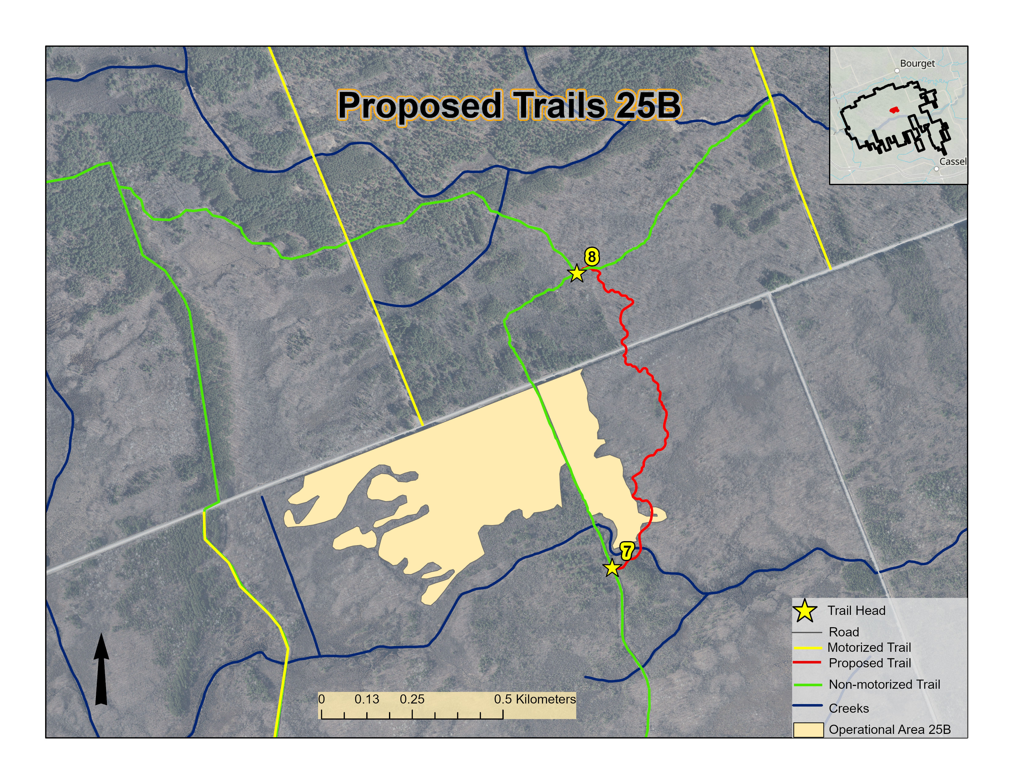
Alternative Trails
Four alternative trails were derived: three for the 22A woodlot, and one in the 25B woodlot. The proposed trails are similar in length to the existing trails. In the figures below, existing trails are shown in yellow (motorized) and green (non-motorized), and the proposed trails are in red.
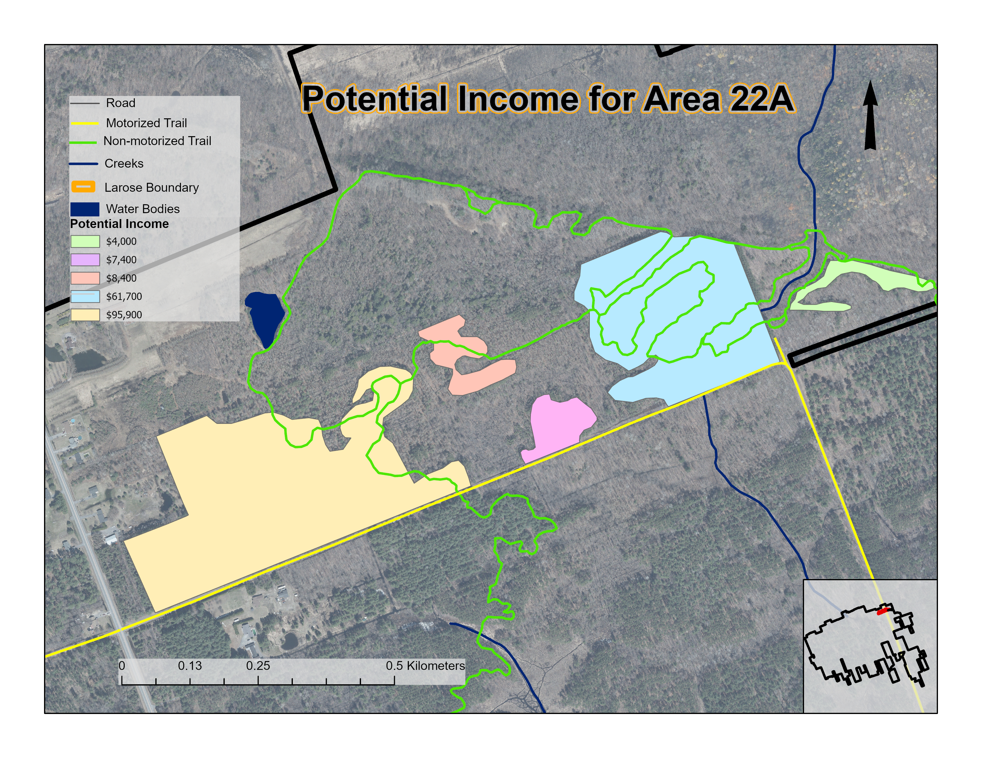
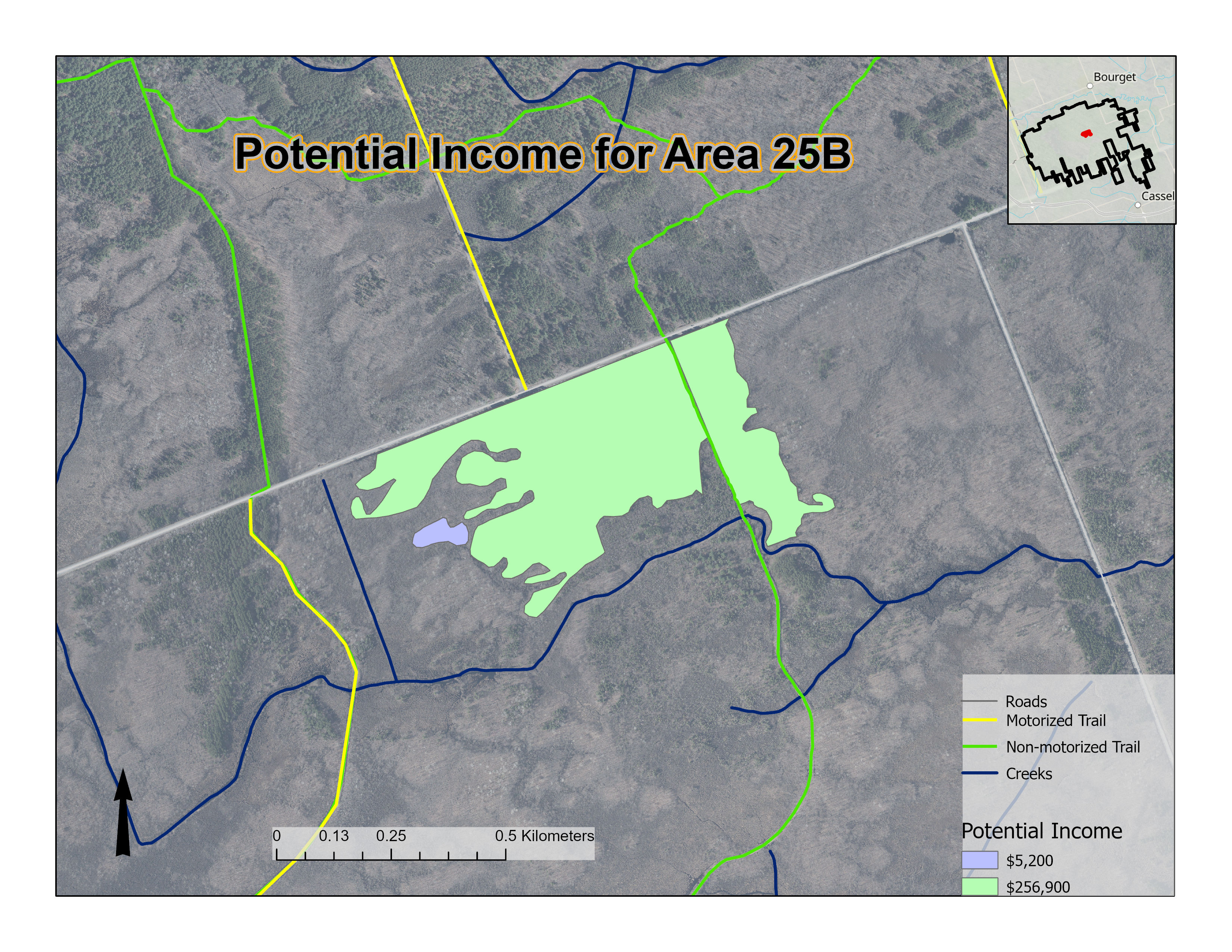
Potential Income from Harvesting
Should harvesting take place within the woodlots as proposed by the Forest Plan, the figures below show the income that could be potentially generated for the County, based on the estimated values provided by the client.
Cartographic Output
The client requested a poster be created that could be used for public meetings, as shown in the figure below.